A-Z Mini Street Atlas - London
Ex VAT (Free UK Delivery Over £125)

| Unit RRP: | £5.95 |
| VAT Rate: | 0% |
| Unit Price (ex. VAT): | £3.57 |
| Unit Price (inc. VAT): | £3.57 |
| Units in Case: | 1 |
| Profit per Unit: | £2.38 |
| Profit per Case: | £2.38 |
| Profit on Return (%): | 40.00% |
| Mark Up (%): | 66.67% |
Calculate Your Profit:
| Profit per Unit: | N/A |
| Profit per Case: | N/A |
| Profit on Return: | N/A |
| Mark Up (%): | N/A |
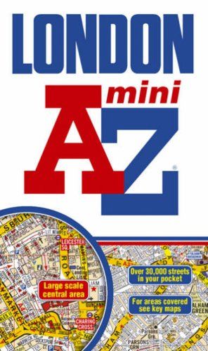
Scale: 3 inches to 1 mile (4.7cm to 1km)
Includes:
•Brent Cross
•Golders Green
•Highgate
•Finsbury Park
•Stoke Newington
•Leytonstone
•Wanstead
•West Ham
•Thames Flood Barrier
•Eltham
•Grove Park
•Catford
•Streatham
•Wimbledon
•Barnes Bridge
•Willesden Junction
•Neasden
Also included is a section of large scale mapping of the inner London area and this extends to: Regent's Park, St. Pancras, Finsbury, Shoreditch, Tower Bridge, The Borough, Westminster Abbey, Belgrave Square and Marble Arch.
One-way streets and safety camera locations with their speed limits are featured on both scales of street mapping.
The congestion charging zone boundary is shown on both scales of mapping and there is also an overview map of the congestion charging zone. The London Underground Map is featured within the atlas and on the outside back cover is a central London Underground Map.
The index section of the atlas lists streets, selected flats, walkways and places of interest, junction, place and area names. There are separate listings for both hospitals, NHS Walk-in Centres and hospices and for National Rail, Docklands Light Railway and London Underground Railway stations, Croydon Tramlink and River Bus stops covered by this publication.
| Series | Mini Map |
|---|---|
| Activity | Driving |
| Brand | A-Z |
| Continent | Europe |
| Country | England |
| Region | Greater London |