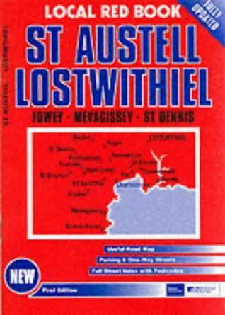
Red Books Street Atlas - St Austell & Lostwithiel
Ex VAT (Free UK Delivery Over £125)

| Unit RRP: | £3.25 |
| VAT Rate: | 0% |
| Unit Price (ex. VAT): | £1.95 |
| Unit Price (inc. VAT): | £1.95 |
| Units in Case: | 1 |
| Profit per Unit: | £1.30 |
| Profit per Case: | £1.30 |
| Profit on Return (%): | 40.00% |
| Mark Up (%): | 66.67% |
Calculate Your Profit:
| Profit per Unit: | N/A |
| Profit per Case: | N/A |
| Profit on Return: | N/A |
| Mark Up (%): | N/A |
A pocket-sized street atlas of St Austell & Lostwithiel, and their surrounding towns and villages. It includes maps, which show hospitals, car parks, post offices, one-way streets, leisure facilities, industrial areas and retail areas, and an index that lists street names and postcodes.
Further DetailThis local street atlas of St Austell & Lostwithiel, and their surrounding towns and villages, gives detailed coverage of the area at a scale of 4 inches to 1 mile. It also includes an enlarged centre map for Exeter at 6 inches to 1 mile. The maps show hospitals, car parks, post offices, one-way streets, leisure facilities, industrial areas and retail areas, while the index lists street names and postcodes. An area road map enables the user to identify through-routes more easily. Pocket sized, and wire stitched so that it opens out flat, the atlas is ideally suited for both business and leisure use, whether by locals or visitors.
| Series | Town Plan |
|---|---|
| Activity | Driving, Travel |
| Brand | RED BOOKS |
| Continent | Europe |
| Country | England |
| Region | Cornwall |