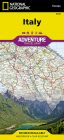
TCI - Road Atlas - Italy
Ex VAT (Free UK Delivery Over £125)


| Unit RRP: | £23.99 |
| VAT Rate: | 0% |
| Unit Price (ex. VAT): | £15.59 |
| Unit Price (inc. VAT): | £15.59 |
| Units in Case: | 1 |
| Profit per Unit: | £8.40 |
| Profit per Case: | £8.40 |
| Profit on Return (%): | 35.01% |
| Mark Up (%): | 53.88% |
Calculate Your Profit:
| Profit per Unit: | N/A |
| Profit per Case: | N/A |
| Profit on Return: | N/A |
| Mark Up (%): | N/A |
Italy Road Atlas at 1:200,000 with TCI (Touring Club Italiano’s) superb cartography.
This atlas ncludes 18 enlargements for metropolitan areas, 119 street plans, an index with over 55,000 entries and several pages of practical information.
The atlas condenses the entire country at a detailed 1:200,000 scale into a single 300 page atlas
Includes:
- Subtle but very effective relief shading Spot heights to present topography
- Names of mountain ranges, valleys and peaks
- National parks and other protected areas are prominently highlighted
- Map legend includes English
- Towns, villages clearly marked Historical and architectural sites
- Holiday resorts, accommodation, hotels, refuges, tourist villages and campsites are included
As you would expect from an atlas of this type, churches, monasteries, castles, palaces, ruins and archaeological sites, caves and waterfalls, etc are all shown.
Road network stands out clearly against the background information. Railways, ferry routes and the country’s regional and provincial boundaries are marked. This atlas does not provide an index or geographical coordinates.
The atlas also includes 18 enlargements at 1:100,000 for the main metropolitan areas, each indicating which part of the town is also covered by a street plan. 119 street plans present central areas of towns from Agrigento to Viterbo, varying in scale from 1:10,000 to 1:20,000. Each plan highlights main traffic arteries, names main streets and comes with a list of churches, historical buildings and museums.
| Activity | Driving, Touring, Travel |
|---|---|
| Continent | Europe |
| Country | Italy |