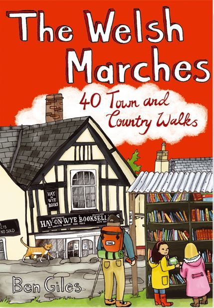
Pocket Mountains - The Welsh Marches
Ex VAT (Free UK Delivery Over £125)


| Unit RRP: | £6.99 |
| VAT Rate: | 0% |
| Unit Price (ex. VAT): | £4.19 |
| Unit Price (inc. VAT): | £4.19 |
| Units in Case: | 0 |
| Profit per Unit: | 0 |
| Profit per Case: | £2.80 |
| Profit on Return (%): | 40.06% |
| Mark Up (%): | 66.83% |
Calculate Your Profit:
| Profit per Unit: | N/A |
| Profit per Case: | N/A |
| Profit on Return: | N/A |
| Mark Up (%): | N/A |
Pocket Mountains - The Welsh Marches
At its fullest extent the Welsh Marches comprises not only all the counties in western England that border with Wales, from Cheshire in the north to Gloucestershire in the south, but also some southern Welsh counties, from Monmouthshire in the east to Pembrokeshire in the west. However, the name is more popularly used to refer to the heart of the border territory of England and Wales – roughly the country lying between, and to the west of, the cities of Shrewsbury and Hereford. It is this smaller area that this guidebook covers. Indeed, the Welsh Marches of Shropshire and Herefordshire have long been true border country.
With a complex and fascinating history, there are wooded river valleys, ruined castles, moorland uplands and ancient market towns, making this perfect walking country for those who prefer a gentler pace and time to explore along the way.
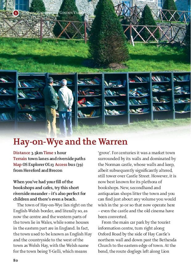
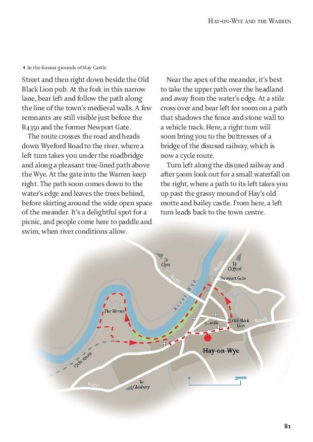
Encircling this area of the Marches are two of Britain’s great rivers. Rising close to each other in mid-Wales, the River Severn passes to the north through Shrewsbury on its great clockwise arc to its estuary beyond Gloucester, while the Wye heads southwards before taking a more easterly course through Hay-on-Wye towards Hereford and on finally to join the Severn at Chepstow. It is here also that the lowlands of England rise from the industrialised Midlands to meet the moorland hills of Wales at the former hunting ranges of the Clun, Mortimer and Radnor Forests. Flowing from this higher ground between the Severn and the Wye are the smaller rivers that serve the towns of the Marches – the Clun and Teme for Knighton and Ludlow, the Lugg and Arrow for Presteigne, Kington and Leominster. In addition, just to the south of the River Wye, hidden away in the shadow of the northern escarpment of the Black Mountains, lie the secluded Golden Valley and the headwaters of the River Monnow. It is often said, but no less true for this, that few parts of Britain can match the varied landscape of the Welsh Marches.
About this guide
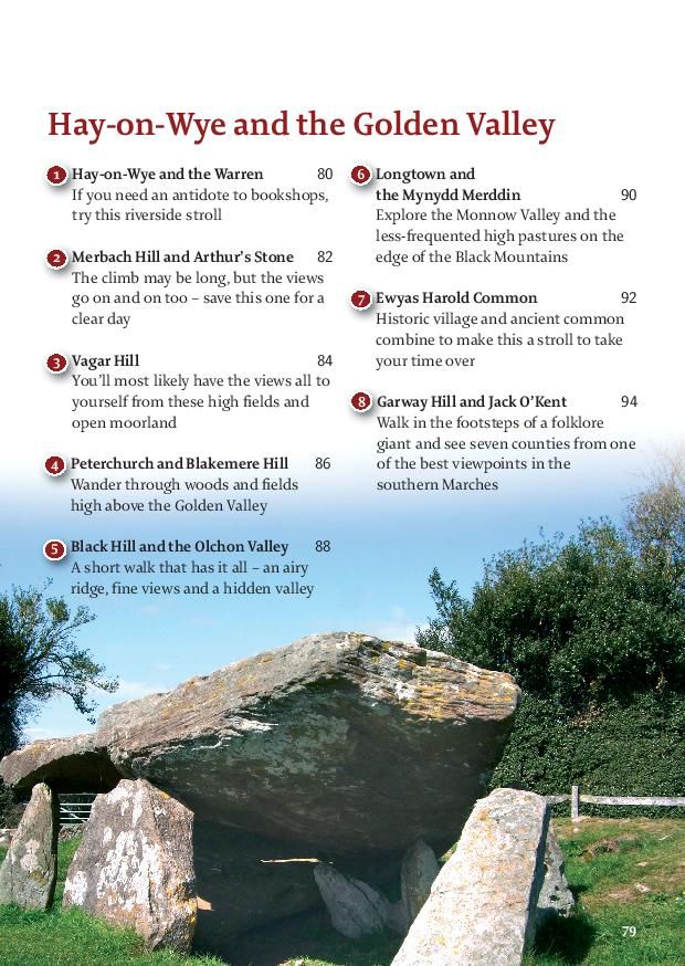
This guide contains forty circular routes in Shropshire, Herefordshire and Powys, ranging in length from 3km to 16km. Most of the routes are intended as comfortable walks or strolls – at most requiring half a summer’s day to complete, though a good number can be completed in just an hour or two. On some routes the cumulative ascent or the terrain itself may require greater exertion or concentration, but in general the walking is on well-worn paths, lanes and tracks, with plenty of waymarks which should require minimal time and effort for route-finding. The route descriptions concentrate on the salient points of navigation, but do not cover every twist and turn. If in doubt, the obvious path is usually the line to take. In addition, the accompanying sketch maps serve an illustrative purpose and – for the longer, higher or more complex routes – it is recommended that the relevant OS map is carried. The recommended time for each walk is an estimate based on an average walking speed of 4kmph, with an allowance added in for ascent and the type of ground. However, this will vary significantly, not only for individuals but also given the seasonal effects on paths, especially those crossing fields. It is hoped there is plenty of interest along the routes themselves and it would be possible to spread a short walk over a half day. Conversely, most routes are short enough to attempt two in a day.
Getting around
The main cities and towns of the Welsh Marches are Shrewsbury, Church Stretton, Craven Arms, Knighton, Ludlow, Presteigne, Kington, Leominster, Hay-on-Wye and Hereford. All have regular bus routes, while mainline railways run between Shrewsbury and Hereford and from Craven Arms through Knighton into Mid Wales. An effort has been made to start walks from places which are served by public transport and it would usually be possible to plan the completion of a walk from a town to coincide with train times. However, many of the outlying rural areas are only intermittently served by public bus on both a weekly and seasonal basis. In addition, Shropshire Hills Shuttles run a bus service at weekends and on Bank Holiday Mondays from April to September, with routes starting from Church Stretton and Craven Arms.
However, access by car is the preferred option for many and, while towns cater adequately for parking, this can be a sensitive issue in small villages and hamlets. Pubs and inns can be very accommodating if the intention is to visit before or after a walk, but where parking is outwith designated car parks consideration should be shown for the needs and access of local residents. Further information is available from tourist information centres in the towns listed above.
Countryside access
The Welsh Marches is an area of mixed farming, with arable, dairy and sheep farming all present. At lambing time, farmers request that dogs are kept on leads. The presence of dogs for cows with calves can be problematic and it is not unheard of for cattle to behave in a very protective way. Even without a dog, cows which have recently calved should be left well alone. If in doubt, it is usually advisable and possible to find a short detour to avoid such livestock. Most paths covered in the routes are well-used and well-maintained by local agencies, but in spring and summer especially hedges and undergrowth grow vigorously and nettles, brambles and bracken can infiltrate narrower paths and stile crossings. Since 2000 the Countryside Rights of Way Act has opened up legal access to large areas of uplands and moorland. In addition, some areas of woodland may have local access agreements. However, sensitivity should be shown for grazing livestock and ground-nesting birds. OS maps mark the limit of access land, where open country is shaded in yellow, while on the ground look out for the circular brown discs with the symbol of a walker against a white background.
| Series | 40 Favourite Walks |
|---|---|
| Brand | Pocket Mountains |
| Continent | Europe |
| Country | Wales |