Harvey Ultra Map - North York Moors West - XT40
SKU
HUM29
RRP
£11.50
Trade Price
£7.13
Ex VAT (Free UK Delivery Over £125)
Profit £4.37 (38%)
Ex VAT (Free UK Delivery Over £125)
normally in stock

| Unit RRP: | £11.50 |
| VAT Rate: | 0% |
| Unit Price (ex. VAT): | £7.13 |
| Unit Price (inc. VAT): | £7.13 |
| Units in Case: | 1 |
| Profit per Unit: | £4.37 |
| Profit per Case: | £4.37 |
| Profit on Return (%): | 38.00% |
| Mark Up (%): | 61.29% |
Calculate Your Profit:
| Profit per Unit: | N/A |
| Profit per Case: | N/A |
| Profit on Return: | N/A |
| Mark Up (%): | N/A |
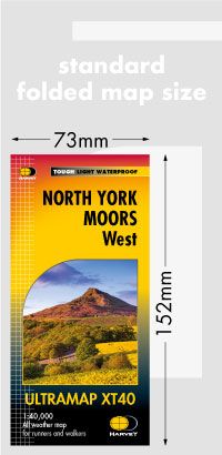
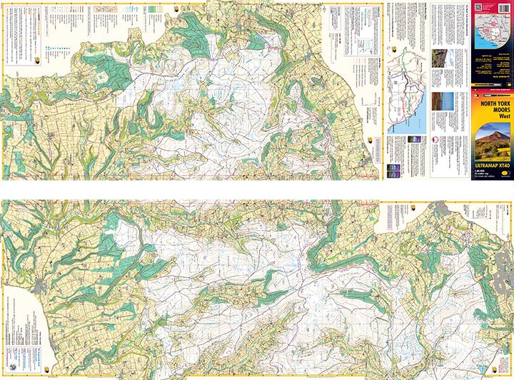
Harvey Ultra Map XT40 - North York Moors West
1:40,000 Scale
Covers a large area yet is handily compact. Pocket perfect!
Detailed map for runners and walkers of the western section of the North York Moors National Park at the magic scale of 1:40,000.
Includes the popular Hambleton Hills and Cleveland Hills.
Roseberry Topping, Sutton Bank and the White Horse.
The Lyke Wake Walk is marked.
Fully detailed genuine HARVEY mapping
Includes Rights of Way
Use without a map case: tough and 100% waterproof
Opens directly to either side of the sheet
Technical specification
Scale: 1:40,000
Ratio: 2.5cm = 1km
Flat size: 870 x 304mm
Folded size: 73 x 152mm
Weight: 25gms
Area of mapping: 605sqkm
Double sided: yes
| Series | Ultra Maps |
|---|---|
| Activity | Cycling, Horse Riding, Orienteering, Walking |
| Brand | HARVEY |
| Continent | Europe |
| Country | England |
| Region | Yorkshire |
Write Your Own Review