OS Admin Boundry Map - North England
Ex VAT (Free UK Delivery Over £125)


| Unit RRP: | £20.00 |
| VAT Rate: | 0% |
| Unit Price (ex. VAT): | £12.00 |
| Unit Price (inc. VAT): | £12.00 |
| Units in Case: | 1 |
| Profit per Unit: | £8.00 |
| Profit per Case: | £8.00 |
| Profit on Return (%): | 40.00% |
| Mark Up (%): | 66.67% |
Calculate Your Profit:
| Profit per Unit: | N/A |
| Profit per Case: | N/A |
| Profit on Return: | N/A |
| Mark Up (%): | N/A |
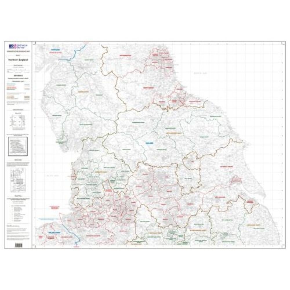
Admin Boundary Map - North England
Administrative boundary maps are definitive graphic maps outlining all unitary, local authority, European and Westminster parliamentary boundaries in Great Britain. Administrative boundary maps are ideal for identifying which local authorities need to be contacted when planning large ventures such as road construction or building projects. They are also a useful addition to archival records in libraries, educational and legal establishments and local government offices.There are eight maps at 1:250 000 scale together covering the whole of Great Britain, following the sheetlines of the OS Travel Maps – Road series, showing unitary and local authority boundaries. A further two at 1:625 000 cover the whole of the country, indicating European and Westminster boundaries.
| Series | Admin Boundry Maps |
|---|---|
| Brand | OS |
| Continent | Europe |
| Country | England |