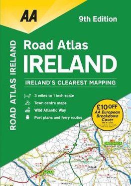
AA - Road Atlas - Ireland
SKU
AA4
RRP
£7.99
Trade Price
£4.79
Ex VAT (Free UK Delivery Over £125)
Profit £3.20 (40.05%)
Ex VAT (Free UK Delivery Over £125)
normally in stock

| Unit RRP: | £7.99 |
| VAT Rate: | 0% |
| Unit Price (ex. VAT): | £4.79 |
| Unit Price (inc. VAT): | £4.79 |
| Units in Case: | 1 |
| Profit per Unit: | £3.20 |
| Profit per Case: | £3.20 |
| Profit on Return (%): | 40.05% |
| Mark Up (%): | 66.81% |
Calculate Your Profit:
| Profit per Unit: | N/A |
| Profit per Case: | N/A |
| Profit on Return: | N/A |
| Mark Up (%): | N/A |
AA Ireland Road Atlas
Scale: 1:200,000
Updated from Ireland's Official Mapping Agencies, OSI and OSNI, this atlas includes AA approved camping sites and AA recommended golf courses, car parks, picnic sites, port plans and ferry routes. Plus, motorway strip maps detailing all of Ireland's motorway junctions. There are 11 detailed city and town plans: Belfast, Cork, Londonderry, Dublin, Galway, Killarney, Kilkenny, Limerick, Sligo and Waterford and an easy-to-read 3,500 place name index, including tourist sites.
| Series | Road Atlases |
|---|---|
| Activity | Driving, Touring, Travel |
| Brand | AA |
| Continent | Europe |
| Country | Ireland |
Write Your Own Review
We found other products you might like!