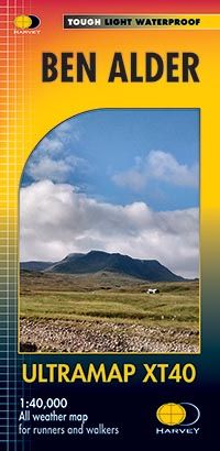
Harvey Ultra Map - Ben Alder XT40
SKU
HUM18
RRP
£11.50
Trade Price
£7.13
Ex VAT (Free UK Delivery Over £125)
Profit £4.37 (38%)
Ex VAT (Free UK Delivery Over £125)
number left in stock4


| Unit RRP: | £11.50 |
| VAT Rate: | 0% |
| Unit Price (ex. VAT): | £7.13 |
| Unit Price (inc. VAT): | £7.13 |
| Units in Case: | 1 |
| Profit per Unit: | £4.37 |
| Profit per Case: | £4.37 |
| Profit on Return (%): | 38.00% |
| Mark Up (%): | 61.29% |
Calculate Your Profit:
| Profit per Unit: | N/A |
| Profit per Case: | N/A |
| Profit on Return: | N/A |
| Mark Up (%): | N/A |
Harvey Ultra Map XT40 - Snowdonia North
1:40,000 Scale
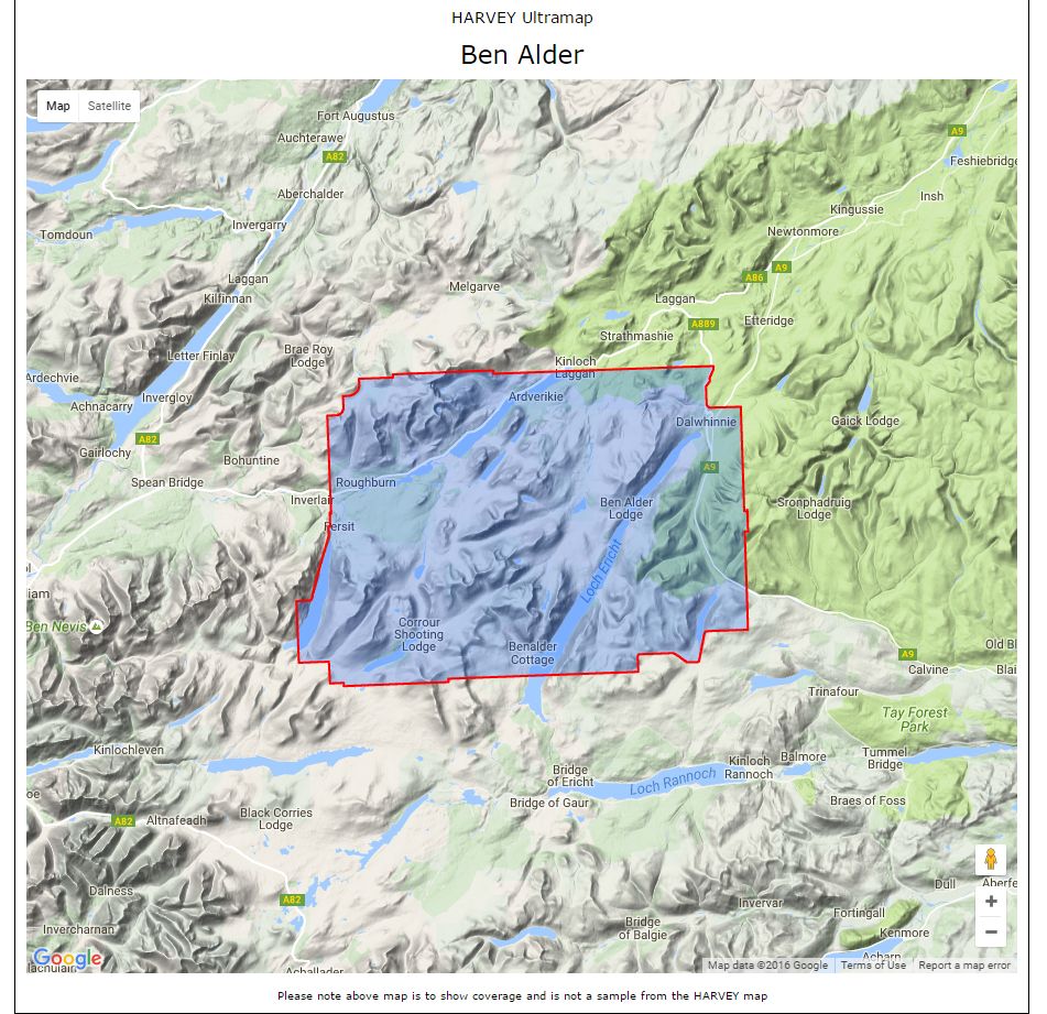
Includes Creag Meaghaidh and Corrour Station.
Detailed map for runners and walkers at the magic scale of 1:40,000 of the area around Ben Alder west of Dalwhinnie and the A9.
Includes 23 Munros, 4 Corbetts and 3 Grahams.
40 years’ experience have gone into HARVEY’s most creative new series. Slim and light, the Ultramap covers a large area and yet is handily compact. Pocket perfect!
- The Ultramap covers a large area yet is small enough to slip in a pocket
- The Ultramap is fully detailed genuine original HARVEY mapping.
- The Ultramap is tough and 100% waterproof. Use it without a map case, whatever the weather!
- To provide the biggest area on the smallest lightest sheet, the Ultramap is printed double sided.
- The ingenious folding pattern allows you to open the Ultramap directly to any part, and either side, of the sheet
- The two sides are aligned, so when you reach the edge of the Ultramap sheet you simply flip it over without re-folding. There’s an overlap as well, so you can map read continuously
- The magic scale of 1:40,000 enables the Ultramap to provide all the detail you would expect to find on a large scale walking map, including rights of way and boundaries
- Plastic pocket for protection
Confidence
- Ultra tough
- Ultra light
- Ultra compact
- 100% waterproof
Quality
- No compromise - original HARVEY mapping for sure navigation
- Opens directly to any part, and either side, of the sheet
- National Grid for reference
Value
- Large area in handy format
- Built to cope with rough conditions
- Weighs just 25g
| Series | Ultra Maps |
|---|---|
| Activity | Cycling, Horse Riding, Orienteering, Walking |
| Brand | HARVEY |
| Continent | Europe |
| Country | Scotland |
| Region | Highland |
Write Your Own Review