Cicerone - National Trail Map Booklet - West Highland Way (MB)
Ex VAT (Free UK Delivery Over £125)

| Unit RRP: | £9.95 |
| VAT Rate: | 0% |
| Unit Price (ex. VAT): | £6.17 |
| Unit Price (inc. VAT): | £6.17 |
| Units in Case: | 1 |
| Profit per Unit: | £3.78 |
| Profit per Case: | £3.78 |
| Profit on Return (%): | 37.99% |
| Mark Up (%): | 61.26% |
Calculate Your Profit:
| Profit per Unit: | N/A |
| Profit per Case: | N/A |
| Profit on Return: | N/A |
| Mark Up (%): | N/A |
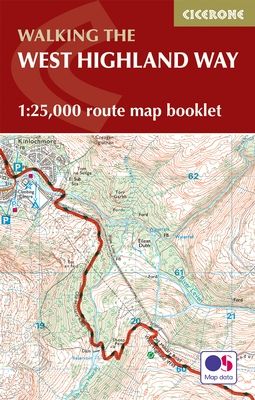
Cicerone - West Highland Way Map Booklet
This booklet of Ordnance Survey 1:25,000 Explorer maps has been designed for convenient use on the trail. It shows the full and up-to-date line of the Way, along with the relevant extract from the OS Explorer map legend. It is conveniently sized for slipping into a jacket pocket or top of a rucksack and comes in a clear PVC sleeve.
All the mapping you need to complete the 95 mile (153km) West Highland Way, an official Scottish Long Distance Route from Milngavie near Glasgow to Fort William. Showcasing the wild beauty of western Scotland, the trail is a journey from the lowlands to the highlands, passing Loch Lomond then crossing Rannoch Moor before finishing in the shadow of Britain's highest mountain, Ben Nevis. The walk takes roughly a week to complete and is presented in seven stages ranging from 8 to 20 miles.
NOTE An accompanying Cicerone guidebook – The West Highland Way – describes the full route with lots of other practical, historical and cultural information. The guidebook INCLUDES a copy of this map booklet.
Activities
long-distance trekking
Seasons
May-June and September-October avoid the worst of the midges, but suitably experienced backpackers can do this walk at any time of year.
Centres
Milngavie, Drymen, Crianlarich, Tyndrum, Kinlochleven, Fort William
Difficulty
The walking is not difficult for anyone accustomed to regular walks longer than 10 miles, although there is ample scope to shorten almost all of the days, and to offload the pack carrying onto an independent service that will transport your baggage for you.
Must See
Loch Lomond, Rannoch Moor, Glencoe, Buachaille Etive Mòr, the Devil's Staircase, Lairig Mòr
| Series | National Trails |
|---|---|
| Activity | Walking |
| Brand | CICERONE |
| Continent | Europe |
| Country | Scotland |
| Region | Highland |