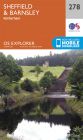
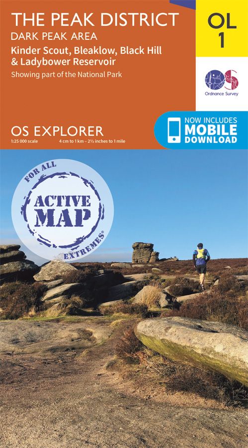
OS Explorer Active - 1 - The Peak District Dark Peak area
Ex VAT (Free UK Delivery Over £125)


| Unit RRP: | £16.99 |
| VAT Rate: | 0% |
| Unit Price (ex. VAT): | £9.34 |
| Unit Price (inc. VAT): | £9.34 |
| Units in Case: | 1 |
| Profit per Unit: | £7.65 |
| Profit per Case: | £7.65 |
| Profit on Return (%): | 45.03% |
| Mark Up (%): | 81.91% |
Calculate Your Profit:
| Profit per Unit: | N/A |
| Profit per Case: | N/A |
| Profit on Return: | N/A |
| Mark Up (%): | N/A |
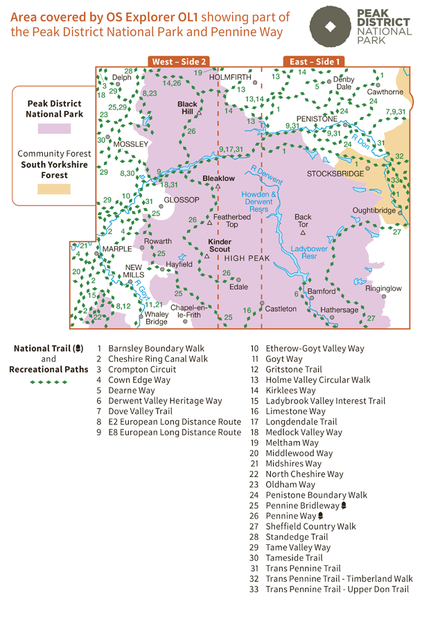
OL1 - The Peak District, Dark Peak area Explorer Active Map
1:25 000 scale (4 cm to 1 km – 2.5 inches to 1 mile) The essential map for outdoor activities.
OS Explorer Map is the Ordnance Survey’s most detailed folding map and is recommended for anyone enjoying outdoor activities including walking, horse riding and off-road cycling. Providing complete GB coverage, the OS Explorer map series details information essential in the great outdoors, including youth hostels, pubs and visitor information. Rights of way, fences, permissive paths and bridleways are clearly shown, ensuring you have the best information to get the most out of your time in the countryside.
Customers can now discover the landscape in all weathers thanks to OS Explorer Map
– Active, a tough, versatile version of the OS Explorer map.
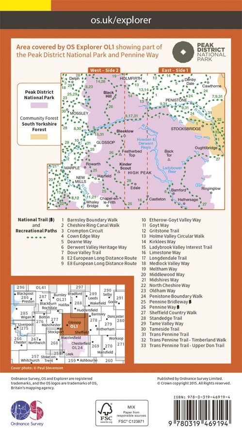
OL1 The Peak District, Dark Peak area featuring :-
- Pennine Way
- Pennine Bridleway
- Gritstone Trail
- Limestone Way
- Middlewood Way
- Cheshire Ring Canal Walk
- Kirklees Way
- Dearne Way
- Holme Valley Circular Walk
- Oldham Way
- Goyt Way
- Longdendale Trail
- Cown Edge Way
- Medlock Valley Way
- Standedge Trail
- Crompton Circuit
- Hills and Hamlets Walk
- Midshires Way
- Dove Valley Trail
- Barnsley Boundary Walk
- Tameside Trail
- Etherow-Goyt Valley way
- Penistone Boundary Walk
- Trans Pennine Trail
- Ladybrook Valley Interest Trail
- Tame Valley Way
- Derwent Valley Heritage Way
- Elsecar to Wortley Trail
- Pennine Way (National Trail)
- E2 (European Long Distance Route)
- Pennine Bridleway (National Trail)
- Cheshire
- Peak District National Park
- West Yorkshire
- Greater Manchester
- South Yorkshire
- Derbyshire
| Series | Explorer Active Maps |
|---|---|
| Activity | Cycling, Horse Riding, Orienteering, Walking |
| Brand | OS |
| Country | England, UK |